 By admin
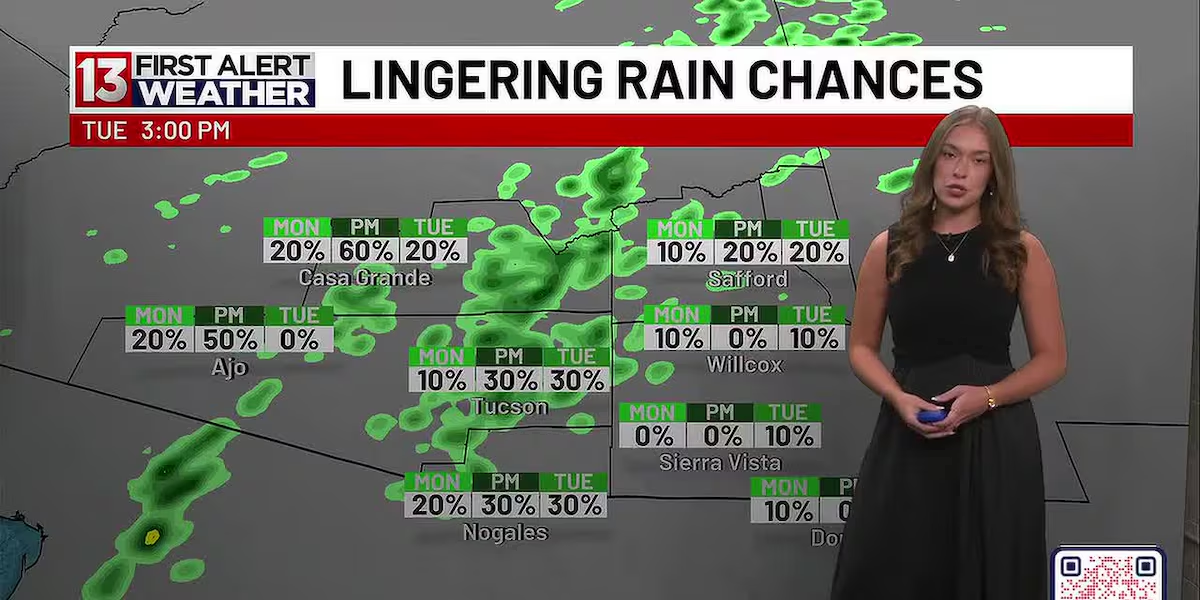
TUCSON, Ariz. (13 News) – Spotty rain showers linger as moisture continues to move in from the south. The best chance for rain coming up is Monday night and Tuesday as a deep trough moves through Arizona. However, it still looks spotty at best with best chances for Tucson and westward.
Read more Clive Barker’s Hellraiser: Revival has such sights to show you…if you can get past the gameplay
Winds will remain breezy Monday but not as elevated as today. They’ll lower midweek before gusty winds return late week. Friday looks to be the day winds peak, but we’ll know more as we get closer to that time period.
Otherwise, enjoy the lovely fall temperatures ahead. Low 80s come around tomorrow before that trough brings even cooler temperatures midweek. Upper-70s are likely Tuesday and Wednesday. Warming back to the low 80s for late week and weekend, but that’s still below normal for us this time of year.
First Alert 7-Day Forecast:
Sunday Night – A 10 percent chance of showers. Mostly cloudy, with a low around 64. Breezy.
Read more PCSD rescues injured hiker from Sabino Canyon
Columbus Day – A 10 percent chance of showers. Partly sunny, with a high near 82. Breezy.
Monday Night – A 30 percent chance of showers and thunderstorms. Mostly cloudy, with a low around 63.
Tuesday – A 30 percent chance of showers and thunderstorms. Partly sunny, with a high near 78.
Read more Two injured in shooting near 10th Avenue, 22nd Street
Tuesday Night –Mostly cloudy, with a low around 57.
Wednesday – Mostly sunny, with a high near 77.
Wednesday Night – Mostly cloudy, with a low around 56.
Thursday – Sunny, with a high near 83.
Thursday Night – Clear, with a low around 63.
Friday – Sunny, with a high near 82. Breezy.
Friday Night – Clear, with a low around 63.
Saturday – Sunny, with a high near 80.
Saturday Night – Clear, with a low around 62.
Sunday – Sunny, with a high near 82.