TUCSON, Ariz. (13 News) – Partly cloudy skies today, with a bit more sunshine than yesterday. There’s a slight chance of dry thunderstorms developing later this afternoon near the Arizona–New Mexico border.
Read more Extreme heat is ahead plus moisture increases
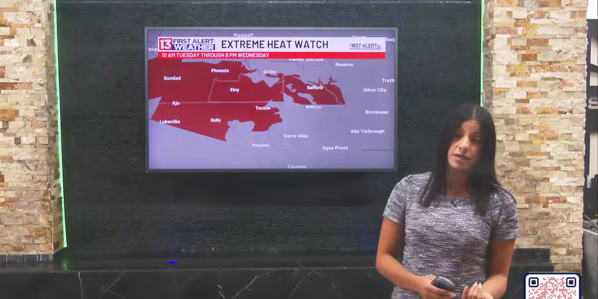
Today also kicks off a warming trend, bringing extreme heat and dangerously hot conditions back to the region. An Extreme Heat Watch is in effect from 10 AM Tuesday through 8 PM Wednesday, impacting metro Tucson and western Pima County, where highs may reach 107° and hotter.
Read more ‘Multiple victims’ in shooting at Westgate Entertainment District, police say
Moisture increases mid to late week, with shower and thunderstorm chances rising each day. Thursday currently looks like our best chance for storms in Tucson. Main impacts include gusty winds and localized flooding.
Read more Crews respond to fatal crash on Davis-Monthan Air Force Base
First Alert 7 Day:
Today: Partly cloudy, with a high near 105.
Tonight: Mostly clear, with a low around 79.
Monday: Sunny, with a high near 107.
Monday Night: Mostly clear, with a low around 81.
Tuesday: Sunny, with a high near 108.
Tuesday Night: Mostly cloudy with a low around 81.
Wednesday: Mostly sunny and a 10% rain chance, with a high near 108.
Wednesday Night: Partly cloudy and a 20% rain chance, with a low around 81.
Thursday: Partly cloudy and a 30% rain chance with storms, with a high near 106.
Thursday Night: Mostly cloudy and a 30% rain chance, with a low around 78.
Friday: Mostly sunny and a 20% rain chance, with a high near 103.
Friday Night: Mostly cloudy and a 20% rain chance, with a low around 78.
Saturday: Partly cloudy and a 20% rain chance, with a high near 102.
Saturday Night: Mostly cloudy and a 20% rain chance, with a low around 78.