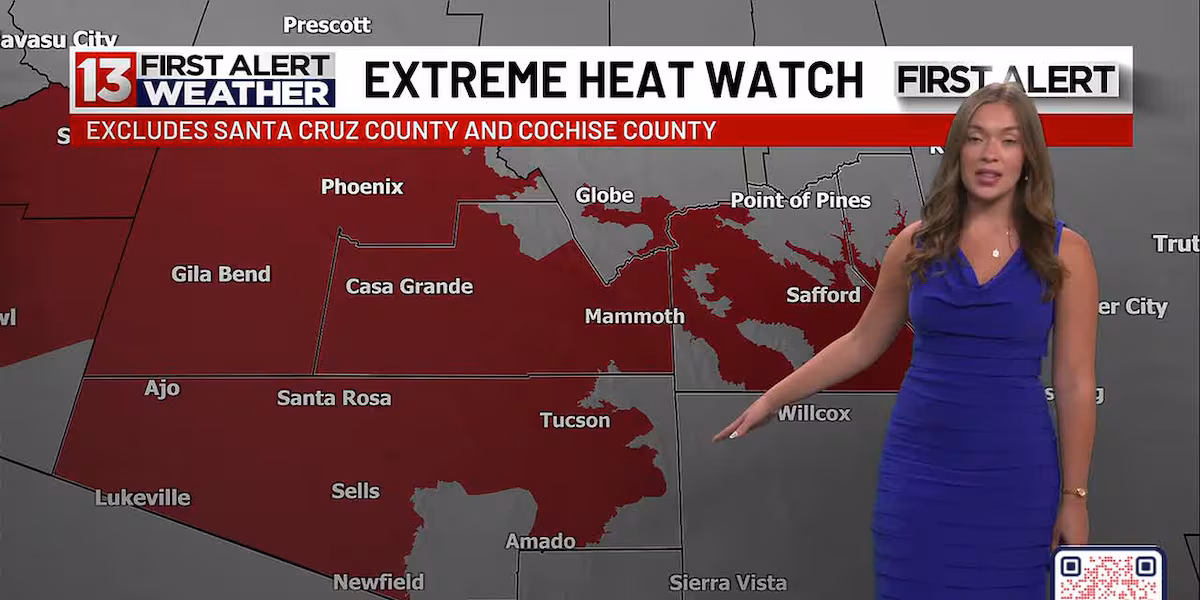
TUCSON, Ariz. (13 News) – Heat increases Sunday and into the workweek with highs peaking Tuesday and Wednesday in Tucson around 108°. Because of that, an Extreme Heat Watch has been issued by the National Weather Service for Tuesday at 10am through Wednesday at 8pm. This is for much of Southern Arizona including much of Pima, Pinal, Graham, and Greenlee Counties and including the Tucson Metro Area. The watch excludes Santa Cruz and Cochise Counties. This will make Tuesday and Wednesday First Alert Weather Days.
Read more Crews respond to fatal crash on Davis-Monthan Air Force Base
Heat starts to back down later in the week but moisture starts to creep into the Tucson area. Precipitation chances are around for areas near the New Mexico border as early as Monday/Tuesday, but Tucson and Pima County will see precipitation chances enter more so into Wednesday/Thursday. Threats include winds and flood concerns.
Read more Tucson Police search for missing and vulnerable adult
Saturday Night: Partly cloudy, with a low around 78.
Sunday: Partly cloudy, with a high near 105.
Sunday Night: Mostly clear, with a low around 79.
Monday: Sunny, with a high near 107.
Monday Night: Mostly clear, with a low around 81.
Tuesday: Sunny, with a high near 108.
Tuesday Night: Mostly cloudy with a low around 81.
Wednesday: Mostly sunny and a 10% rain chance, with a high near 108.
Wednesday Night: Partly cloudy and a 20% rain chance, with a low around 81.
Thursday: Partly cloudy and a 30% rain chance with storms, with a high near 106.
Thursday Night: Mostly cloudy and a 30% rain chance, with a low around 78.
Friday: Mostly sunny and a 20% rain chance, with a high near 103.
Friday Night: Mostly cloudy and a 20% rain chance, with a low around 78.
Saturday: Partly cloudy and a 20% rain chance, with a high near 102.
Saturday Night: Mostly cloudy and a 20% rain chance, with a low around 78.