TUCSON, Ariz. (13 News) – Happy Father’s Day and first day of summer! Summer is making a statement for it’s first official week. High pressure stays in control, sending temperatures higher by midweek—easily bringing the hottest readings we’ve seen so far this year.
Read more Summer kicks off with increasing temperatures
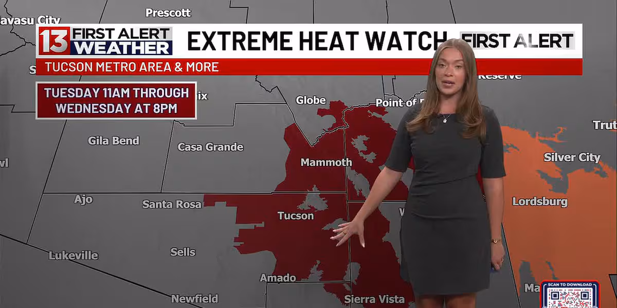
With the rising heat, moderate to major heat risk levels are likely with isolated areas of extreme heat risk. Because of this heat, an Extreme Heat Watch has been issued for portion of Southern Arizona starting Tuesday at 11am through Wednesday at 8pm. This includes Eastern Pima County and the Tucson Metro Area, Eastern Pinal County, Southern Greenlee County, Western Cochise County, and much of Graham County. Stay cool, drink plenty of water, and limit time outdoors during peak afternoon hours.
Read more Steamy for Father’s Day & the first day of summer
Models still hint at increasing moisture towards the end of the week, but rain chances remain slim for regions mostly south and east of Tucson. An upper-level low in the Pacific Northwest may nudge high pressure further south, allowing temperatures to ease back toward seasonal averages next weekend—though overall conditions stay dry, with triple-digit heat.
Read more Tucson family needs help finding missing woman
FIRST ALERT 7 DAY:
Tonight: Clear, with a low around 73.
Monday: Sunny, with a high near 106.
Monday Night: Clear, with a low around 77.
Tuesday: Sunny, with a high near 108.
Tuesday Night: Clear, with a low around 79.
Wednesday: Sunny, with a high near 109.
Wednesday Night: Clear, with a low around 81.
Thursday: Sunny, with a high near 109.
Thursday Night: Clear, with a low around 80. 10% chance of rain/storms.
Friday: Mostly sunny, with a high near 107.10% chance of rain/storms.
Friday Night: Clear, with a low around 79.
Saturday: Sunny, with a high near 104.
Saturday Night: Clear, with a low around 77.
Sunday: Sunny, with a high near 103.