 By admin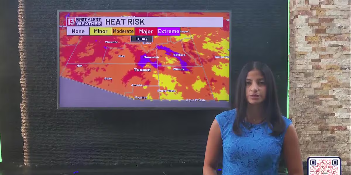
TUCSON, Ariz. (13 News) – A major heat risk returns with climbing temperatures this afternoon, along with a slim chance for late-evening showers and thunderstorms. Similar temperatures are expected tomorrow, though some areas may trend a degree or two cooler. Highs will drop back into the 90s by midweek as rain and storm chances remain in the forecast, with models hinting at the most active weather arriving midweek.
Read more Man living in Tucson accused of killing girlfriend, fleeing country
First Alert 7 Day Forecast:
Today – Increasing clouds and hot, with a high near 106. Chance of precipitation is 10%.
Tonight – A 10 percent chance of showers and thunderstorms. Partly cloudy, with a low around 79.
Sunday – Sunny and hot, with a high near 105.
Sunday Night – A 30 percent chance of showers and thunderstorms. Mostly cloudy, with a low around 77.
Monday – A 30 percent chance of showers and thunderstorms. Mostly sunny, with a high near 102.
Monday Night – Showers and thunderstorms likely. Mostly cloudy, with a low around 75. Chance of precipitation is 70%.
Tuesday – A 30 percent chance of showers and thunderstorms. Mostly sunny, with a high near 98.
Read more 1 critical, 1 hurt after shooting leaves car crashed into Avondale home
Tuesday Night – A 50 percent chance of showers and thunderstorms. Mostly cloudy, with a low around 75.
Wednesday – A 60 percent chance of showers and thunderstorms. Mostly cloudy, with a high near 97.
Wednesday Night – A 50 percent chance of showers and thunderstorms. Mostly cloudy, with a low around 75.
Thursday – A 30 percent chance of showers and thunderstorms. Mostly sunny, with a high near 97.
Thursday Night – A 20 percent chance of showers and thunderstorms. Mostly cloudy, with a low around 76.
Friday – A 10 percent chance of showers and thunderstorms. Mostly sunny, with a high near 99.
Read more Chandler ends use of Flock license plate readers after audit finds ‘anomaly’