 By admin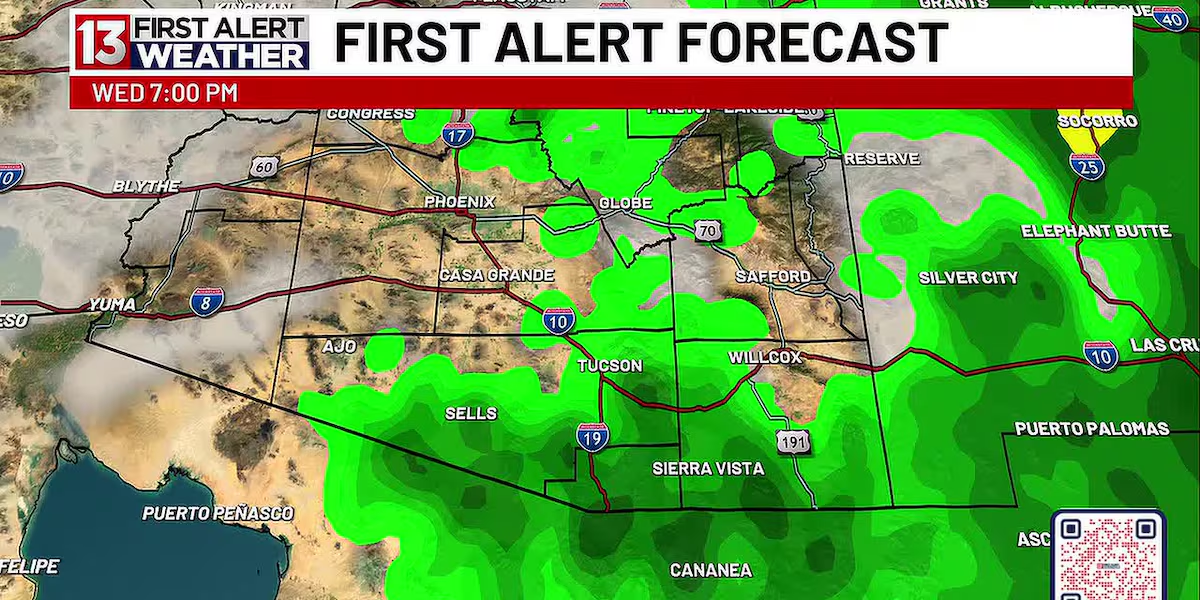
TUCSON, Ariz. (13 News) – Today was warm with partly cloudy skies and building moisture. Radar showed isolated, weak showers across Southeast Arizona this evening. Moisture deepens Tuesday into midweek, bringing afternoon and evening storm chances across our 7-day forecast. Forecast models have shifted the timing, placing metro Tucson’s best rain chance between Tuesday and Thursday, with even greater chances to the south and east.
Read more Bicyclist suffers life threatening injuries in Pima County crash
Temperatures will hover near seasonal averages, cooling into the low-to-mid 90s during the day and the 70s overnight. The first day of fall arrives Tuesday, offering a great excuse to cozy up inside as scattered storms roll through.
FIRST ALERT 7-DAY FORECAST:
Tonight: Mostly clear, with a low around 71.
Monday: Mostly sunny, with a high near 97. 10% chance of rain.
Monday Night: Mostly clear, with a low around 72.
Tuesday: 30 percent chance of showers and thunderstorms, with a high near 94.
Tuesday Night: 20 percent chance of showers.Partly cloudy, with a low around 71.
Wednesday: 20 percent chance of showers and thunderstorms, with a high near 92.
Wednesday Night: 30 percent chance of showers and storms.Partly cloudy, with a low around 70.
Thursday: 20 percent chance of showers and thunderstorms, with a high near 92.
Thursday Night: 30 percent chance of showers and storms.Partly cloudy, with a low around 70.
Friday: 20 percent chance of showers and thunderstorms, with a high near 92.
Friday Night: 10 percent chance of showers and storms.Partly cloudy, with a low around 73.
Read more Moisture increasing in Southern Arizona as we head into the workweek
Saturday: A 10 percent chance of showers and storms. Mostly sunny, with a high near 94.
Saturday Night: A 10 percent chance of showers and storms. Partly cloudy, with a low around 72.
Sunday: A 20 percent chance of showers and storms. Partly cloudy, with a high near 94.